Kwabene in Kitindi
02. Getting to Kitindi (in theory)

This week, for the second time in as many months, I will arrive in Kitindi. The circumstances are quite different this time, however, because this time it is to stay. God-willing, Henri and I will arrive Wednesday (Aug 17) by flight with Mission Aviation Fellowship, accompanied by my tatis (grandparents). This flight has already been rescheduled once, however, so we shall see exactly how our arrival plays out. For now, I will share how past trips have gone so you can have an idea of what we are about to undergo and what has been undergone before us.
Before one can even proceed to Kitindi, one must first get to eastern Congo, which is a process in itself. International Berean Ministries teams have always reached Congo by way of Rwanda. Rwanda offers U.S. passport holders visas upon arrival, so this means one must simply fly to Rwanda’s capital of Kigali. Once there, one must travel about 260 kilometers (by plane or bus) to reach the border with Congo. Rwanda and Congo are separated by Lake Kivu and the Ruzizi River, which includes a border crossing into Bukavu, the capital of South Kivu (one of Congo’s easternmost provinces). Unfortunately, Congo does not issue visas upon arrival to U.S. citizens. This means that before one leaves, one needs to send one’s passport and an application to Washington, D.C., from whence they will then be sent to the Congo’s capital, Kinshasa. Assuming one gets one’s entry approved and passport returned, one can then make the trip to Kigali and then to the border and then into the DRC!
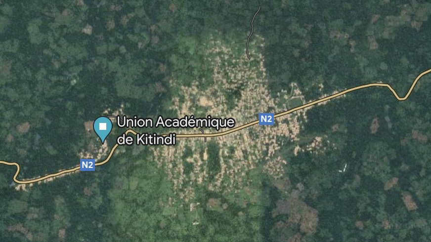
Kitindi is situated in the southwest of South Kivu. By road, the village of around 12,000 is located 275 kilometers from Bukavu (slightly less as the crow flies). Kitindi is not too hard to find because the region’s main road, Route Nationale Deux (RN2), runs directly through it, and one can follow this road between it and Bukavu. Google Maps estimates that it would take a car about 9 hours traveling on this main “highway” to reach the village from the city. However, this is easier said than done. I put the word “highway” in scare quotes because the road, which is paved as it traverses through Bukavu and its environs, is not so well-maintained elsewhere. Reddish-brown or tannish depending on what section you are on, the majority of RN2 is a dirt road. This may be well enough if the road was consistent in construction, but it is far from it. It is full of “potholes” that can be a couple of feet deep (in truth, sometimes the road seems to be more pothole than road) and, in some sections, is no wider than a walking path. As a consequence, it is impossible to take a normal car from Bukavu to the village. One would need either a heavy-duty truck to absorb the potholes and crush the brush that lines its margins, or one would need to abandon the car about halfway to the village and take a motorcycle the rest of the way.

The latter strategy is exactly the one I used when I first visited Kitindi in 2017. It took me and my team about two days instead of nine hours, though. We left Bukavu one morning in a convoy of two or three cars and took RN2 to a city about halfway to the village called Kamituga*. We then spent the night in the city and hired motorcycles to take us and all our luggage to the village, still about 100 kilometers away. I cannot recall the total travel time each day, but I know the cumulative total was more than nine hours. Taking the car was miserable because of the dust of the road, the beating of the sun, and the constant shaking of the ride, despite the driver’s best efforts. However, the open air and weaving of the motorcycle through the hilly and forested countryside was quite fun and an experience I hope to relive sometime this year.
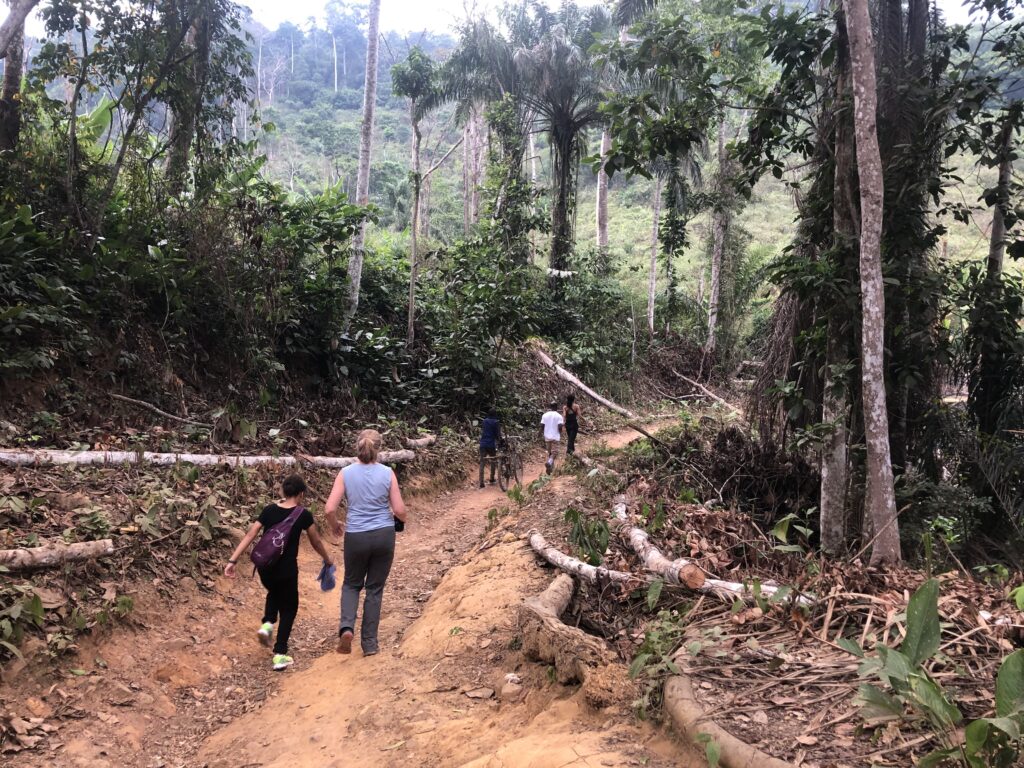
Before this road option, my father once led a team to the village by way of a combined flight and grueling ten to twelve-hour walk. The team would arrive in Lugushwa (not featured on Google Maps), a town east of the village. The team would then hike all day along a well-traversed, red dirt path through the rainforest from Lugushwa to Kitindi, passing three or four villages and crossing the Elila River along the way. The team members and hired porters would have to work together to carry all their baggage on their own backs (or heads as locals tend to do). Thankfully, we’ve abandoned this method at this point.
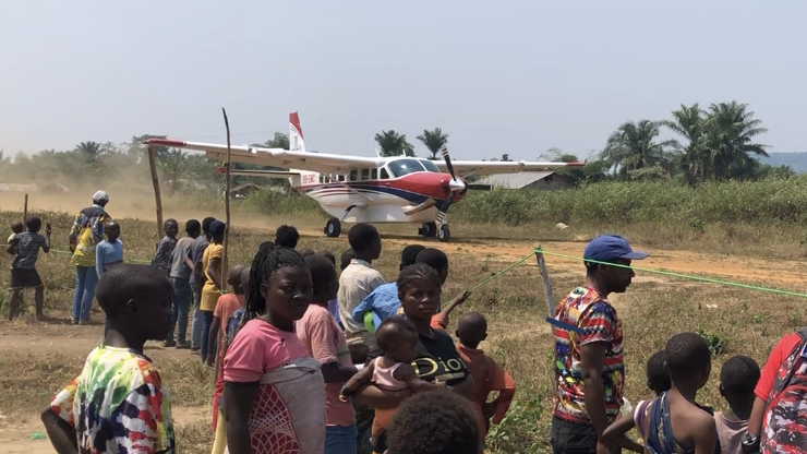
When my whole family visited last month, we hired a plane piloted by Mission Aviation Fellowship. Though not always maintained, Kitindi does have a dirt airstrip that can be used to reach the village. On our entry this week, Henri and I plan to take this route again. The plane ride is just about an hour from the airport near Bukavu to the village, and the arrival of l’avion is quite an event for the village kids to witness.

I will be an unpaid volunteer teacher at Union Academique de Kitindi for the 2022-23 academic year. Please consider giving as you are able by clicking the button below or addressing a check to International Berean Ministries and including my name on the memo line. Donations cover room, board, and travel expenses.
International Berean Ministries
PO Box 88311
Kentwood, MI 49518-0311

*for some reason, Kitindi is currently marked as Kamituga on Google Maps, even though the real Kamituga is miles away.
Hey Kwabene,
I love reading this blog post. I am going to pass this in to some of my friends to share with other prospective missionary teachers.